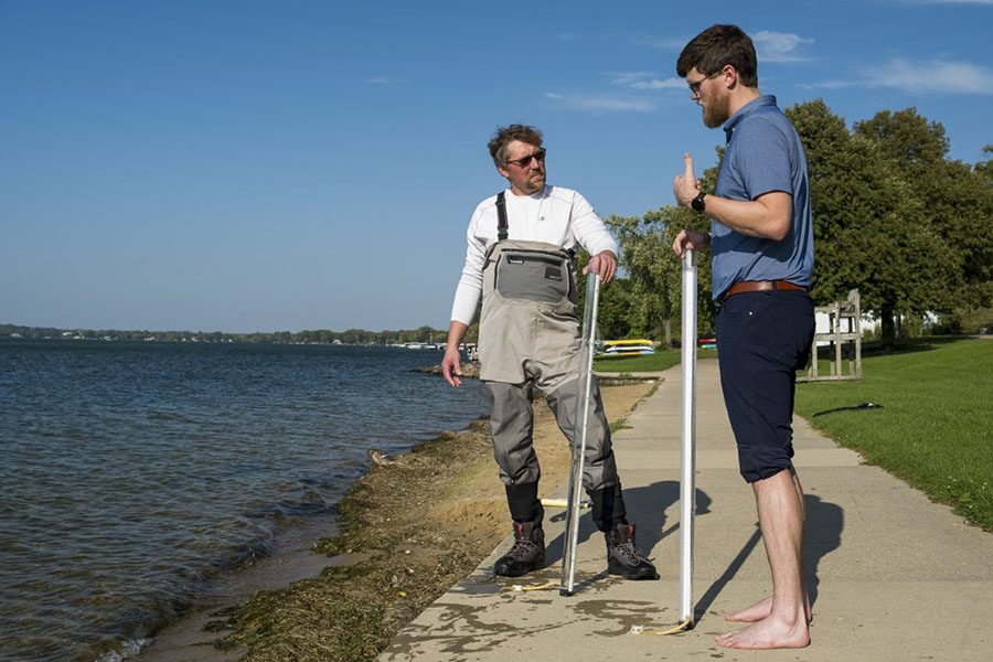
Britton Downing, left, meets with Luke Wynn of the Nearshore Water Quality Monitoring program at James Madison Park.
Into the Field: Monitoring Area Lakes
The Clean Lakes Alliance tracks changes in area waterways
October 16, 2019
On a typical windy fall day, Luke Wynn and I walked down to the beach at James Madison park, with our turbidity tubes in hand. Wynn runs the Nearshore Water Quality Monitoring program for Clean Lakes Alliance, and we were headed into Lake Mendota to do a training session for the program.
The Nearshore Water Quality Monitoring program is open to anyone who is capable of safely walking about 3 feet into a lake while carrying a turbidity tube, and then entering the data they collect online. The program monitors quantitative and qualitative measures of conditions at beaches and private properties across the entire chain of lakes in the Yahara river watershed. During the training Wynn explains these measures and their usefulness. Quantitative measures are scientific in nature and they include water temperature, air temperature, and turbidity of the water (a measure of clarity.) Qualitative observations are visual, and they include wave intensity, waterfowl presence, algae blooms, bather load, and a couple of others.
Although throwing around scientific terms like qualitative and quantitative might sound intimidating, Wynn makes the training easy to understand.

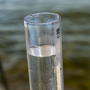
A sample of water from Lake Mendota fills a turbidity tube for a visual observation of water clarity.
First, we take a fast reading thermometer and measure the air and water temperature. We also use the thermometer to test what kind of algal blooms are present by simply swirling it in the water. Algal blooms such as Cyanobacteria can produce dangerous neurotoxins that can be fatal if swallowed.
At this point we take our turbidity tubes, submerge them, and take the water we have collected on shore. Everything else is done visually. The tubes are drained at a slow rate until the observer can see the Secchi disk at the bottom. This allows for a measure of particulate matter in the water column.
Volunteers also collect as much visual data about the site as is available. Amount of people in the water, and the amount of waterfowl present can be related to the load of bacterial species in the water, such as E. Coli. Wave intensity is also easy to discern and proves to be an additional safety metric. After recording measurements, volunteers simply enter them in at www.Lakeforecast.org.
This is the point where citizen science meets public safety relevance. Clean Lakes Alliance helped develop a mobile friendly app that gives real time conditions at beaches on the Yahara chain. The simple data collected is monitored by scientists who alert Public Safety if indicated. Then if there is a potential threat to public safety, higher level scientific testing can be done onsite within as little as 30 minutes.
Even though this data is useful for long term studies of this chain of lakes, the public safety implications of this work cannot be understated. That is why Clean Lakes Alliance is looking for more volunteers. This is a perfect opportunity for any student, especially those in environmental sciences. The program formally runs from May 23 until Sept. 3, but volunteers are encouraged to start earlier and sample through the end of September if possible. Preferred sampling frequency is twice a week, but once again, volunteers are encouraged to sample more if possible. Training usually occurs from the end of March through May.
If you are interested in more information, contact Luke Wynn at Clean Lakes Alliance or visit the organization’s website.
